HighWater™
Infrastructure-Facilities PM SolutionsSafeguard your mission from rising storms, tides,
and sea levels with HighWater™
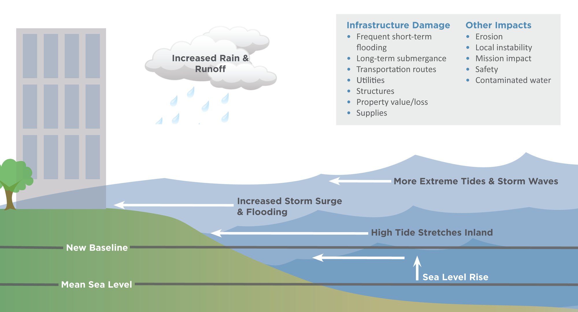
HighWater™ is an advanced modeling tool and data to forecast the impact and penetration of increased storms and flooding. As industry experts, we deliver enduring solutions, ensuring a proactive approach to the challenges posed by escalating storms, tides, and sea level rise. We assess risk to ensure you maintain operational readiness, create mitigation plans, and then manage the plan to completion.
“In this new era of extreme rains, runoff, storms, and record sea level, a new kind of planning is warranted.”
– John Englander, Author of High Tide on Main Street: Rising Sea Level and the Coming Coastal Crisis and Founder of the International Sea Level Institute
HighWater™ assesses these risks
-
Flooding
-
Extreme high tides
-
Storm surges
-
Land loss due to erosion
-
Sea-level rise
Ready to get started?
Contact us today to learn more about our design management solution or infrastructure and facilities project management offerings.

The Benefits of HighWater™
Despite the versatile nature of increased flooding, response systems have been sluggish in adequately preparing educational institutions, businesses, communities, and government agencies for their profound impact on security, mission, and operations. The surge in storms, tides, and sea level rise has established a new baseline, requiring a recalibration of how we calculate and anticipate flooding events. Conducting scenario-based modeling and a comprehensive risk assessment to gauge the potential repercussions is imperative.
Our HighWater™ Quick Guide
Our four-phase, HighWater™ Quick Guide focuses on developing individual action plans for clients’ coastal properties.


